List of Iona place-names beginning with 'P'
Poll a’ Bhaile
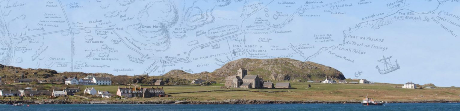
Kilfinichen & Kilvickeon (KKV), Iona (IOX)
Classification: Water
Grid reference: NM2887423977
Certainty: 1
Altitude: m
Elements: G poll + G an + G baile
Translation: 'pool of the town'
Poll Dubhaich
Kilfinichen & Kilvickeon (KKV), Iona (IOX)
Classification: Relief
Grid reference: NM2739323913
Certainty: 1
Altitude: 20m
Elements: G poll + G dubhach
Translation: 'peat pit/mire' or 'dark pit/mire'
Poll Dùnain
Kilfinichen & Kilvickeon (KKV)
Classification: Water
Grid reference: NM2860326053
Certainty: 1
Altitude: m
Elements: G poll + G dùnan
Translation: 'pool of the knoll'
Pollarain
Kilfinichen & Kilvickeon (KKV), Iona (IOX)
Classification: Coastal, Water
Grid reference: NM2632524275
Certainty: 1
Altitude: 2m
Elements: G poll + G -ar + G -an
Translation: ?'place of pools'
Port a’ Chroisein
Kilfinichen & Kilvickeon (KKV), Iona (IOX)
Classification: Coastal
Grid reference: NM2865324089
Certainty: 1
Altitude: 2m
Elements: G port + G an + G croisean
Translation: 'port of the little cross'
Port a’ Churaich
Kilfinichen & Kilvickeon (KKV), Iona (IOX)
Classification: Coastal
Grid reference: NM2630121653
Certainty: 1
Altitude: 1m
Elements: G port + G an + G curach
Translation: 'port of the coracle'
Description:
A port at the southern end of Iona. Although Port a’ Churaich is sometimes equated with the name St Columba’s Bay, often used in an English-speaking context (for which see entry), the former refers to the landing-place, whereas the latter refers to the adjacent body of water. The bay is divided by a large rocky elevation known as Eilean Port a’ Churaich and Port a’ Churaich refers to the eastern portion of the bay, whereas the landing place to the west is known as Port an Fhir-bhrèige. Both names are traditionally associated with the arrival of St Columba and his companions at this site in 563. The whole area is a popular tourist spot, known for its distinctive coloured rocks, described in numerous traveller accounts. Pennant (1774, 297) gives the following description:
the landing place of St. Columba; a small bay, with a pebbly beach, mixed with variety of pretty stones, such as violet-colored Quartz, Nephritic stones, and fragments of porphyry, granite and Zaeblitz marble: a vast tract near this place was covered with heaps of stones, of unequal sizes: these, as is said, were the penances of monks who were to raise heaps of dimensions equal to their crimes: and to judge by some, it is no breach of charity to think there were among them enormous sinners
It is described in the OS Name Books (OS1/2/77/140) as:
“Port na Currach “the bay of the Boat.” On the southwest side is a still more inconsiderable creek than the Bay of Martyrs, and derives both its name and all its importance from the tradition of its having been the landing place of the currach, the hide and timber boat of St. Columba. On the shore of Port-na-Currach are some irregular heaps of pebbles thrown apparently by the sea, but one of which, a heap about 50 feet long is represented by legendary gossip as a memorial and an exact model of St. Columba’s Boat, while others are alleged to be results and monuments of acts of penance performed by the monks”. Extracts from Imperial Gazetteer of Scotland. Meaning “Bay of the Boat”.
Our early forms of the name present a problem; although we would typically expect G curach to be feminine, thus giving Port na Curach (as in the OS forms and multiple other sources), the name consistently appears as Port a’ Churaich with curach as a masculine noun. Notably, the latter form is certainly the more prominent one in local usage, as reflected in sources like the Ritchies and oral accounts (e.g. see TAD ID 84012 part 2 15:30).
Some sources use the element curachan ‘little coracle’ with the Gaelic suffix -an (used to denote small size) added, possibly influenced by the name for the mound located at the bay, An Curachan (TAD ID 17784; MacCulloch 1819, 21). Although lacking any historical basis, the mound is traditionally known as the boat St Columba arrived in.
The name is first mentioned by Mánus Ó Dómhnaill in his Betha Coluim Chille (1532) as ‘Port an Curaigh’, but he incorrectly locates it on the coastline near Rèilig Odhrain (timcell reilge Odhráin). It is next mentioned in a letter from 1701 (Wodrow Letters 1834, 115), therein described as:
a harbour, a mile distant, westward from the buildings of the place, where stons maybe found, as clear many of them, as some glasses; this harbour is called Port Achurnich, from the ship that Calimkill and his associats came upon from Ireland to that place. The length of this Curachan or ship is obvious to any who goes to the place, it being marked up att the head of the harbour upon the grass, between two litle pillars of ston set up to shew forth the samin, between which pillars there is three score of foots in lenth, which was the exact length of the Curachan or ship.
The port is subsequently mentioned in a myriad of traveller accounts during the early modern period, including some of the greats of 18th- and 19th-century Iona literature such as Pococke, Boswell, MacMillan and Trenholme (see early forms). Considering the complete absence of any references to St Columba arriving in this part of the island pre-dating the early modern period, it seems highly likely that both name and tradition are the result of a re-imagining of Iona’s history.
As noted above, this site has become one of the most popular tourist spots on Iona beyond the area surrounding the Abbey. Undoubtedly, this is in part due to its perceived strong association with St Columba himself. We should, however, be aware that a potential consequence of its popularity in a visitor context may contribute to the gradual decline of the Gaelic form of the name. We often find that when established English forms exist (in this case St Columba’s Bay), a perceived greater accessibility for tourists may lead to a preference for those English forms. For example, as of 2025, the destination page for the site on Tripadvisor only has the name St. Columba’s Bay.
Port a’ Ghoirtein Bhig
Kilfinichen & Kilvickeon (KKV), Iona (IOX)
Classification: Coastal
Grid reference: NM2621124618
Certainty: 1
Altitude: 2m
Elements: G port + en (An) Goirtean Beag
Translation: 'port of (An) Goirtean Beag'
Port a’ Mhuilinn
Kilfinichen & Kilvickeon (KKV), Iona (IOX)
Classification: Coastal
Grid reference: NM2899024531
Certainty: 1
Altitude: m
Elements: G port + G an + G muileann
Translation: 'port of the mill'
Port Adhamhnain
Kilfinichen & Kilvickeon (KKV), Iona (IOX)
Classification: Coastal
Grid reference: NM2865324089
Certainty: 1
Altitude: 2m
Elements: G port + pn Adhamhnan (St)
Translation: '(St) Adhamhnan's port'
Port an Aoinidh
Kilfinichen & Kilvickeon (KKV), Iona (IOX)
Classification: Coastal
Grid reference: NM2544122574
Certainty: 2
Altitude: 7m
Elements: G port + G an + G aoineadh
Translation: 'port of the steep promontory'
Port an Dìseirt
Kilfinichen & Kilvickeon (KKV), Iona (IOX)
Classification: Coastal
Grid reference: NM2911124679
Certainty: 1
Altitude: m
Elements: G port + G an + G dìseart or en (An) Dìseart
Translation: 'port of the "desert" or hermitage'
Description:
This little bay or landing place is very close to the ruined buildings and other constructions now known as Cladh an Dìseirt, ‘burial ground of the “desert” or hermitage’, and must take its name from that feature. We should note that neither the port nor the cladh is named prior to the nineteenth century, and this (and Cladh an Dìseirt) may be modern names created to evoke the monastic landscape of the past, to re-sacralise a landscape which had to a great extent been de-sacralised following the collapse of monastic life and pilgrimage at the Reformation. On the other hand, the use of the element dìseart at such a late date seems unusual, and they may reflect early coinings. For discussion of the supposed dìseart or hermitage, see Cladh an Dìseirt.
Port an Duine Mhairbh
Kilfinichen & Kilvickeon (KKV), Iona (IOX)
Classification: Coastal
Grid reference: NM2643624883
Certainty: 1
Altitude: 4m
Elements: G port + G an + G duine + G marbh
Translation: 'port of the dead man'
Description:
This name refers to an inlet on the western coast of Iona, directly south-west of Dùn Mhanannain. It is described in the OS Name Books (OS1/2/37/51) as ‘A small bay on the south side of Dùn Manamin, and a short distance north west of Cùl an Dùin’.
Peter MacInnes gives the following account regarding the name: ‘all I heard was that it took its name from a body being discovered there at one time away in the long ago’ (TAD ID84321 3:55). The name is also discussed by Dugald MacArthur (TAD ID84012 part 1, 37:00-37.30). He has no specific information regarding the name, but he does state that it is very old. He also gives the following information: ‘during the first war it was one of the half a dozen or so merchant navy corps that landed on the island when we were school boys did come into Port an Duine Mhairbh’, but he states that this event has nothing to do with this name.
Since it applies to a coastal feature the most logical explanation is probably the one suggested by MacInnes, i.e. that a body washed up on the shore and was found there. However, we should note some of the other contexts in which references to dead people are found in place-names, both in Scots, English and Gaelic (represented by elements like duine marbh or dead man). Traditions associated with these names recorded in the OS Name Books range from men who fell in a battle (Dead-men’s Holm in Ayrshire OS1/3/62/39) to a farmer who perished in a snow storm (Dead Man’s Den in Aberdeenshire OS1/1/57/95). Other examples include Dead Man’s Bay (Kirkcudbrightshire), Dead Man’s Cairn (Kincardineshire), Dead Man’s Weil (Kirkcudbrightshire), Nick of the Dead Man’s Banes (Kirkcudbrightshire), Cnoc an Duine Mhairbh (Lewis).
In Gaelic, there is another Port an Duine Mhairbh on the island of Saoil/Seil for which the OS Name Books (OS1/2/53/84) give the following: ‘A small creek a short distance south of Rudha na Moine. A […] in attempting to desert from a […] ship, which was lying of this bay about 50 years ago was shot just as he landed. Hence the [name] Sign “Dead man’s Port.” [part of the page is missing]’. We also have Port an Duine Mhairbh on Giogha ‘where the dead body of a man was found’ (OS1/2/5/24) and Creagan an Duine Mhairbh on Islay which refers to ‘a small rock on the high water mark’ (OS1/2/40/46).
Who was the dead man in Port an Duine Mhairbh on Iona? There are several references to members of the local community of Iona drowning at, or near, coastal features to be found in place-names, but these often commemorate the person in question, by name or epithet (examples include Geodha Ruaraidh and Nead a’ Ghille Ruaidh, for which see entries). In this instance, it may be more likely that the body in question belonged to an unknown person, perhaps washed ashore from a ship or shipwreck. This would be consistent with other references to unnamed dead men noted above.
Port an Fhir-bhrèige
Kilfinichen & Kilvickeon (KKV)
Classification: Coastal
Grid reference: NM2624121738
Certainty: 1
Altitude: 3m
Elements: G port + G an + G fear-brèige
Translation: 'port of the false man'
Port an t-Sruthain
Kilfinichen & Kilvickeon (KKV), Iona (IOX)
Classification: Coastal
Grid reference: NM2865924125
Certainty: 1
Altitude: 2m
Elements: G port + G an + G sruthan
Translation: 'port of the small stream'
Port Aoineadh an Taghain
Kilfinichen & Kilvickeon (KKV), Iona (IOX)
Classification: Coastal
Grid reference: NM2566921941
Certainty: 1
Altitude: 10m
Elements: G port + en Aoineadh an Taghain
Translation: 'port of Aoineadh an Taghain'
Port Aoineadh nan Sruth
Kilfinichen & Kilvickeon (KKV), Iona (IOX)
Classification: Coastal
Grid reference: NM2545622101
Certainty: 1
Altitude: 8m
Elements: G port + en Aoineadh nan Sruth
Translation: 'port of Aoineadh nan Sruth'
Port Bàn
Kilfinichen & Kilvickeon (KKV), Iona (IOX)
Classification: Coastal
Grid reference: NM2628824415
Certainty: 1
Altitude: 2m
Elements: G port + G bàn
Translation: 'white/fair port'
Port Beag na Sliginich
Kilfinichen & Kilvickeon (KKV), Iona (IOX)
Classification: Coastal
Grid reference: NM2831923423
Certainty: 1
Altitude: 1m
Elements: G port + G beag + en (An) t-Sligeanach
Translation: 'little port of (An) t-Sligeanach'
Port Beul Mòr
Kilfinichen & Kilvickeon (KKV), Iona (IOX)
Classification: Coastal
Grid reference: NM2572522612
Certainty: 1
Altitude: 6m
Elements: G port + en (Am) Beul Mòr
Translation: 'port of Beul Mòr'
Port Càrnan a’ Ghille
Kilfinichen & Kilvickeon (KKV), Iona (IOX)
Classification: Coastal
Grid reference: NM2698721898
Certainty: 1
Altitude: 8m
Elements: G port + en *Càrnan a’ Ghille
Translation: 'port of Càrnan a’ Ghille'
Port Carraig an Daimh
Kilfinichen & Kilvickeon (KKV), Iona (IOX)
Classification: Coastal
Grid reference: NM2737125542
Certainty: 1
Altitude: 1m
Elements: G port + en Carraig an Daimh
Translation: 'port of Carraig an Daimh'
Description:
A small, rocky port located directly next to Carraig an Daimh, from which it derives its name. It is described in the OS Name Books (OS1/2/37/48) as ‘a port situate about ¾ of a mile W. of Dùn I’ and about ¾ of a mile N.E. of “Chorr Sgeir”, Sig; Port of the rock of the oxen,’. Reeves lenites G carraig in the existing name, but D. Munro Fraser/Ritchie and the OS maps do not, which is in line with Gaelic grammatical convention.
Port Ceann a’ Ghàrraidh
Kilfinichen & Kilvickeon (KKV), Iona (IOX)
Classification: Coastal
Grid reference: NM2817723212
Certainty: 1
Altitude: m
Elements: G port + en *Ceann a’ Ghàrraidh
Translation: 'port of Ceann a’ Ghàrrraidh'
Port Ceann Aindrea
Kilfinichen & Kilvickeon (KKV), Iona (IOX)
Classification: Coastal
Grid reference: NM2649624073
Certainty: 1
Altitude: m
Elements: G port + en Ceann Aindrea
Translation: 'port of Ceann Aindrea'
Port Ceann an Ùird
Kilfinichen & Kilvickeon (KKV), Iona (IOX)
Classification: Coastal
Grid reference: NM2645921586
Certainty: 1
Altitude: 4m
Elements: G port + en Ceann an Ùird
Translation: 'port of Ceann an Ùird'
Port Ceann na Creige
Kilfinichen & Kilvickeon (KKV), Iona (IOX)
Classification: Coastal
Grid reference: NM2645423204
Certainty: 1
Altitude: 3m
Elements: G port + en Ceann na Creige
Translation: 'port of Ceann na Creige'
Port Clacha Dubha
Kilfinichen & Kilvickeon (KKV)
Classification: Coastal
Grid reference: NM2764525682
Certainty: 1
Altitude: 2m
Elements: G port + en Na Clacha Dubha
Translation: 'port of Na Clacha Dubha'
Port Clacha Geala
Kilfinichen & Kilvickeon (KKV), Iona (IOX)
Classification: Coastal
Grid reference: NM2647023170
Certainty: 1
Altitude: 6m
Elements: G port + en *Na Clacha Geala
Translation: 'port of Na Clacha Geala'
Port Dùnagan
Kilfinichen & Kilvickeon (KKV), Iona (IOX)
Classification: Coastal
Grid reference: NM2844423699
Certainty: 1
Altitude: 2m
Elements: G port + en *Dùnagan
Translation: ?‘port of *Dùnagan’
Description:
A small, rocky port, located directly south of Port nam Mairtir. It is worth noting that the name given by Dugald MacArthur (TAD ID 84012 part 1 24:38) is Port Eilean Dùnagan. This form would appear to be supported by the addition of eilean in brackets in Munro Fraser’s appendix, suggesting that the port may have taken its name from the existing name for the island.
See Eilean Dùnagan for further discussion of the specific element.
Port Ghealtain
Kilfinichen & Kilvickeon (KKV)
Classification: Coastal
Grid reference: NM2664223638
Certainty: 1
Altitude: m
Port Goirtean Ìomhair
Kilfinichen & Kilvickeon (KKV), Iona (IOX)
Classification: Coastal
Grid reference: NM2648221616
Certainty: 1
Altitude: 6m
Elements: G port + en Goirtean Ìomhair
Translation: 'port of Goirtean Ìomhair'
Port Grulainn
Kilfinichen & Kilvickeon (KKV)
Classification: Coastal
Grid reference: NM2643324199
Certainty: 1
Altitude: 2m
Elements: G port + en Grulainn
Port Làraichean
Kilfinichen & Kilvickeon (KKV)
Classification: Coastal
Grid reference: NM2595421737
Certainty: 1
Altitude: 3m
Elements: G port + en Làraichean
Translation: 'port of Làraichean'
Port Lobha
Kilfinichen & Kilvickeon (KKV)
Classification: Coastal
Grid reference: NM2817023153
Certainty: 1
Altitude: m
Elements: G port + G lobhadh
Translation: ?'rotting port'
Port Mùrlugh Cànain
Kilfinichen & Kilvickeon (KKV), Iona (IOX)
Classification: Coastal
Grid reference: NM2749722281
Certainty: 1
Altitude: 8m
Port na Cloiche
Kilfinichen & Kilvickeon (KKV)
Classification: Coastal
Grid reference: NM2665423551
Certainty: 1
Altitude: m
Elements: G port + G an + G clach
Port na Fraing
Kilfinichen & Kilvickeon (KKV)
Classification: Coastal
Grid reference: NM2912825263
Certainty: 1
Altitude: 2m
Elements: G port + en An Fhraing
Port na Muinntir
Kilfinichen & Kilvickeon (KKV)
Classification: Coastal
Grid reference: NM2879124286
Certainty: 1
Altitude: 3m
Elements: G port + G an + G muinntir
Port nam Mairtir
Kilfinichen & Kilvickeon (KKV), Iona (IOX)
Classification: Coastal, Ecclesiastical
Grid reference: NM2848923835
Certainty: 1
Altitude: 2m
Elements: G port + G an + G mairtir
Translation: ‘Martyrs’ Port’
Description:
The name Port nam Mairtir, or ‘Martyrs’ Port’ (and variants), first appears in the surviving record in 1771 – at least in so far as we have been able to find so far. It may be that the name represents a genuine memory of an act of violence passed down over generations of monastic life and then of the local non-monastic community on Iona, perhaps recalling the place of a Viking raid. We know from contemporary annals that several such violent raids took place in the late eighth and ninth centuries, and another mass killing took place in AU 986. If it is a genuine memory of this sort, however, it is slightly strange that there is no record of the name prior to the 1770s, and that it first appears in English rather than Gaelic. It may be that the name was created in the eighteenth century by people who had read of the massacres in the distant past and invented a name for this site which ‘fleshed out’ the stories they had read. It is only natural that a community should create place-names to enrich their landscape by reference to striking events in their history. According to Trenholme (1909, 130) ‘Martir is old Church Irish for the Latin word “martyr”, and was in full use at the period of the first recorded slaughter of Iona monks by the Danes, in the year 806’ and Morrison (1957, 9) similarly states that Vikings ‘murdered sixty-eight of the monks at Martyrs’ Bay’ in 806.
It is possible, however, that the name originated in a medieval context, and that it has been inherited, misunderstood and re-interpreted along the lines of a Viking massacre by early modern commentators. The Latin word martyrium can have a range of meanings. Some of them are related to the idea of martyrdom in the sense of ‘violent death at the hands of someone who hates the Christian faith’, i.e. what a ‘martyr’ suffers. But the range of meanings of martryium was wider than this. The original meaning of Greek martyros is ‘witness’. So a martyr bears witness to Christ by shedding his or her blood. But someone who lives a holy life was also regarded as ‘bearing witness’ by their life. Thus in the early Middle Ages a chronological list of the feast days of the saints, whether they suffered or not, is called a martyrologium or ‘martyrology’. They were ‘martyrs’ in the sense that they bore witness by their lives, rather than by their deaths – what many Late Roman and early medieval writers called ‘white martyrdom’ as opposed to the ‘red martyrdom’ of bloodshed.
Adomnán, the ninth abbot of Iona, used the word martyrium to refer to the large basilica built by Constantine in Jerusalem, supposedly on the site where the Empress Helena had found the True Cross (DLS, 50). The basilica itself bore witness to the crucifixion Christ therefore, just as the church of the Anastasis nearby bore witness to his resurrection. There was no dead body in it.
The word martyrium could also be used of the church or shrine of a saint, or to the actual relics of a saint. and Gaelic martrae shares this wide range of meanings with Latin. It can mean ‘martyrdom’, but also refers to ‘relics’,[1] or a ‘church burial ground’ in early laws.[2] We might recall that a similar development happened in Welsh, where Latin martyrium gave rise to Welsh merthyr (it appears in place-names such as Merthyr Cynog and Merthyr Tudfil).
We might therefore imagine that the origin of the name Port nam Mairtir is not a modern recollection of a Viking act of violence, but an echo of medieval usage. The road from the bay to the abbey was lined with martyria – An Eala, Cladh nan Druineach, Teampall Rònain, Rèilig Odhrain, the monks’ burial ground and the merthyr of Columba himself, not to mention crosses which ‘bore witness’ to the faith. The bay, Port nam Mairtir, may have been named after some of these features during the medieval monastic period, and the name continued long after its original meaning was forgotten.
[1] Trip., 238, 6. ‘Ro facaib sruthi 7 minda 7 martire intib’ (‘[Colum Cille] left therein elders and precious objects and relics’). The same source tells us of Domangart macc Echach: ‘isé tocéba martra Patraic gair riambrath’ (‘it is he that will lift up the relics of Patrick shortly before Doom’): Trip. 120.20.
[2] ALI iv, 86: ‘A fail ata dun rig, les martradh’ (‘When it is the fort of a king, or a churchyard’).
Port nam Mùrlach
Kilfinichen & Kilvickeon (KKV), Iona (IOX)
Classification: Coastal
Grid reference: NM2914125031
Certainty: 1
Altitude: 1m
Elements: G port + G an + G mùrlach
Translation: ‘port of the kingfishers’
Port nan Allt Beag
Kilfinichen & Kilvickeon (KKV)
Classification: Coastal
Grid reference: NM2725322153
Certainty: 1
Altitude: 10m
Elements: G port + G an + G allt + G beag
Translation: 'little landing-place/inlet of the streams'
Description:
This is a small inlet on the south-east of the island, a little south of Tràigh nan Sìolag | Sandeels Bay. Although Munro Fraser (followed by the Iona Community map) translated it as ‘port of the small streams’, that seems ungrammatical, and it is more likely to mean ‘the small landing-place/inlet of the streams’, as if to distinguish it from another inlet (which we have no record of), called *Port nan Allt Mòr. It is worth calling attention to the element allt here, as this element, very common elsewhere, is not well represented in Iona, appearing as a generic only in Allt a’ Chaorainn which is right next to Port nan Allt Beag.
Port Nigheanan Breugaich
Kilfinichen & Kilvickeon (KKV)
Classification: Coastal
Grid reference: NM2648321609
Certainty: 1
Altitude: 6m
Elements: G port + G nighean + G breugach
Translation: 'port of the false/lying girls'
Port Pollarain
Kilfinichen & Kilvickeon (KKV), Iona (IOX)
Classification: Coastal
Grid reference: NM2632524275
Certainty: 1
Altitude: 2m
Elements: G port + en Pollarain
Translation: 'port of Pollarain'
Port Rònain
Kilfinichen & Kilvickeon (KKV), Iona (IOX)
Classification: Coastal
Grid reference: NM2865624083
Certainty: 1
Altitude: 1m
Elements: G port + pn Rònan (St) G Rònnad (St) or
Translation: ‘the port of St Rònan or St Rònnad’
Description:
Port Rònain is the name of the harbour where the ferry still arrives. Unsurprisingly, this name appears in travellers’ accounts, since it was often where they disembarked on the island, and so we have frequent attestations of it. The name clearly refers to the same saint as is present in the name Teampall Rònain, and an extended discussion of the possible identities of this saint can be found under that name. Supporting the argument there, that the saint was not Rònan but Rònag or Rònnad, the mother of St Adomnán, is the earliest form we have of this name, ‘Ronald’s Port’, in 1771. ‘Ronald’ here might just as easily be a typographer’s mistake for ‘Ronad’ or ‘Ronaid’, or indeed a ready Englishing of a less familiar name by the author.
It is interesting that Port Adhamhnain and Port Rònain sit right next to each other on Iona’s shoreline, if the latter was originally Port Rònnaid and named after Adomnán’s mother. The name, at any rate, implies some sort of relationship between it and Teampall Rònain, whether of simple proximity (i.e., this is where one would land if heading for Teampall Rònain, which seems for a time to have been the parish church), or something else.
Port Royal †
Kilfinichen & Kilvickeon (KKV), Iona (IOX)
Classification: Coastal
Grid reference: NM2852123911
Certainty: 2
Altitude: 2m
Translation: 'port royal'